Last week we set a quiz based on our auto-generated map of Gloucestershire. If there were some areas still puzzling you, then worry no longer: the answers are below.
As some people noted, the map extends beyond Gloucestershire, into Herefordshire, Worcestershire and bits of Wales – and it doesn’t cover all of Gloucestershire (the data’s not yet available). Hopefully that didn’t confuse you too much!
- Cleeve Hill (location | orienteering map): distinctive features are the gorse bushes (which show up as patches of vegetation), and lots of quarries.
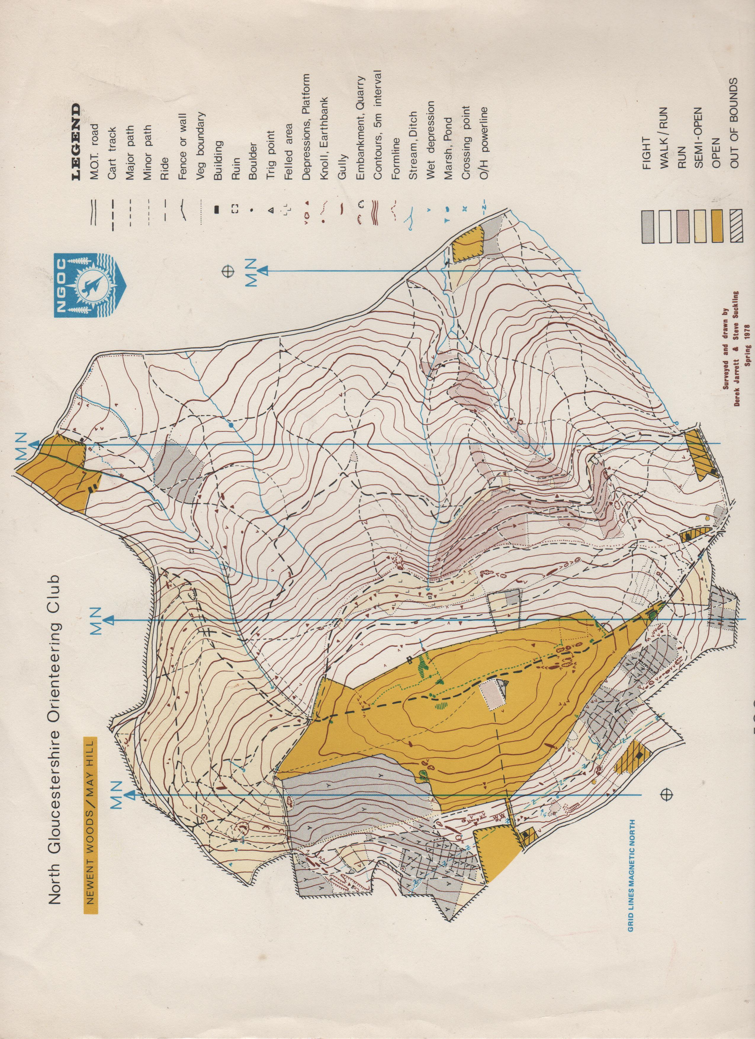
- May Hill (location | old orienteering map): the clump of trees at the top of the hill give this one away. The area hasn’t been used for orienteering since the late 1970s/early 1980s.
- Cranham and Cooper’s Hill (location | orienteering map): as used for our last event before the lockdown.
- Puzzlewood (location): a wood full of rock features and depressions (scowles). I don’t think it’s been used for orienteering.
- Minchinhampton Common (location | orienteering map): a flat open common top with ancient mounds. We held a fast-running event here in early March.
- Haugh Wood and Fownhope Park (location): southeast of Hereford, these areas have been used in the past for big events by Wye Valley Orienteers.
- Bredon Hill (location): another one that’s stretching the definition of Gloucestershire a bit! I can’t find any reference to orienteering events being held on the slopes of Bredon Hill.
- New Beechenhurst, Forest of Dean (location | orienteering map): a distinctive spoil heap here, which BOK have sent us over and around within the past few years.
- Chepstow (location | orienteering map): this is the only urban area on the list, but the unique shape of the River Wye gives it away.
- Cirencester Park (location | old orienteering map): a big but very flat wood, used for an event in the early 1970s but seemingly not since then.
- British Camp (location | orienteering map): outside Gloucestershire again, and the biggest hill fort on this list. British Camp in the Malverns is often used by Harlequins.
- Symonds Yat (location | old orienteering map): again the River Wye makes a distinctive shape around Symonds Yat rock.
- Miserden Estate (location): maybe the hardest question. The Miserden Estate runs along the Frome valley in the Cotswolds: the remains of a 12th century castle stand out by the river.
- Speech House Lake (location | orienteering map): in the Forest of Dean near Speech House. You can make out some of the many drainage ditches around this area.
- Parkend Walk pitted area (location | orienteering map): in the Forest of Dean. Lots of pits!
- Selsley Common (location): a smaller common across the valley from Minchinhampton. We’re hoping to hold a relay there sometime…
- Robinswood Hill (location | old orienteering map): sticking out in the South of Gloucester, Robinswood Hill is another area that was used in the past for orienteering, but not within the last decade.
- Forest of Dean Cycle Centre and Sallowvallets (location | orienteering map): in the Forest of Dean, with mountain-bike tracks down the slope.
- Stinchcombe Hill (location): near Dursley, this hill is encircled by the Cotswold Way and topped with a golf course.
- Lydney Park (location | old orienteering map): more scowles here, in Lydney Park woods near the Forest of Dean. It’s been used in the past for major events, but tricky to get permission.